-
 ×
× - Strona główna
- Wydruki ▸
- Artyści ▸
- Kategorie ▸
- Style sztuki ▸
- Rama ▸
- Nośniki druku ▸
- Wszystkie nośniki druku
- Płótno Leonardo (satyna)
- Płótno Salvador (matowe)
- Płótno Rafael (matowe)
- FineArt - Foto matowy
- FineArt - Foto satyna
- FineArt - Foto baryt
- FineArt - Foto błyszczący
- Tektura akwarelowa Munch
- Tektura akwarelowa Renoir
- Tektura akwarelowa Turner
- Tektura akwarelowa Dürer
- Natural Line Hemp
- Natural Line Rice
- Kozo White, 110g
- Kozo Natural, 110g
- Inbe White, 125g
- Unryu, 55g
- Bamboo, 110g
- Premio Unryu, 165g
- Murakumo Natural, 42g
- Bizan Natural, 300g
- Bizan White, 300g
- Kompozyt aluminiowy 3mm
- Szkło akrylowe 5mm
- Zamów zestaw próbek
- Które medium druku pasuje?
Płótno
Papier fotograficzny
Karton akwarelowy
Natural Line
Papier japoński
Media specjalne
Więcej informacji
- Pomoc i serwis ▸
- Skontaktuj się z nami
- Sprzedaj swoją sztukę
- Najczęściej zadawane pytania
- Oferty pracy
- Reklamacja
- Zamów próbki
- Zamów vouchery
- Koszty wysyłki
- Czas produkcji
- Zrównoważony rozwój
- Wyszukiwanie obrazów
- Specjalne życzenia
- Kim jesteśmy?
- Polityka cenowa
- Polityka firmy
- Obietnica jakości
- Wyróżnienia
- Blejtram
- Passe-partout
- Ramki dekoracyjne
- Szklenie
- Listwy
- Systemy montażowe
- Nośniki druku
- Wskazówki pielęgnacyjne
- Stopka redakcyjna
- Regulamin
- Ochrona danych
- Prawo do odstąpienia od umowy
Informacje i usługi
Więcej informacji
Warto wiedzieć
Informacje prawne
- Sklep ▸
- Kontakt





 Zobacz w 3D / AR
 Dodaj do ulubionych
 Wybierz kolor ściany
 Widok obrazu w pomieszczeniu
.jpg "Mapa kabli podmorskich na całym świecie - w „Przez elektryczność” G. Davy")
.jpg "Imperium Brytyjskie, 1897")
.jpg "Ogólna mapa służąca do wyznaczania trasy statku")
.jpg "Wykres izotermiczny, czyli widok na klimaty i produkcje, ilustracja z Relacji Alexandra von Humboldta, 1823")
.jpg "Etnograficzna mapa świata")
.jpg "Mapa świata według Ptolemeusza, 1923.")
.jpg "Mapa głównych światowych szlaków handlu morskiego, 1912")
.jpg "Ogólna mapa przedstawiająca odkrycia dokonane przez kapitana Jamesa Cooka podczas tej i dwóch poprzednich podróży wraz z trasami statków pod jego dowództwem.")
.jpg "Ogólna mapa linii telegraficznych między Europą, Indiami, Australią i Chinami")
.jpg "Mapy LOC mmorse000105-4")
![Mapa świata linii telegraficznych opublikowana przez Międzynarodowe Biuro Telegraficzne, 1901. Skala: [ok. 1:70 000 000]](/kunstwerke/300px/Unbekannt Unbekannt - World map of telegraph lines published by the International Telegraph Bureau 1901Scale ca 170000000 - (MeisterDrucke-119197).jpg "Mapa świata linii telegraficznych opublikowana przez Międzynarodowe Biuro Telegraficzne, 1901. Skala: [ok. 1:70 000 000]")
.jpg "Mapy LOC mmorse000105-2")
.jpg "Mapa magnetyczna Ziemi")
.jpg "Mapa świata przedstawiająca ślady kapitana Cooka")
.jpg "Mapa świata przedstawiająca posiadłości brytyjskie w 1904 roku.")
.jpg "Ogólny wykres na projekcji Merkatora pokazujący trasę \"Lwa\" i \"Hindostanu\" z Anglii do Zatoki Pekin w Chinach i ich powrót do Anglii.")
.jpg "Mapy LOC mmorse000105-1")
.jpg "Anthropoidea - V. Rozkład map rodzin Hapalidae Red i Cebidae Blue, 1897")
.jpg "Mapa świata przedstawiająca prądy oceaniczne, 1902.")
.jpg "Nowy Atlas Chin, Chiński Tatar i Tybet, Haga 1737.")
.jpg "Mapa przedstawiająca eksport węgla z Wysp Brytyjskich w 1850 r.")
.jpg "Mapa świata na projekcji Mercators, 1902")
.jpg "Mapa świata przedstawiająca przeważające wiatry, 1902.")
.jpg "Mapa trans-saharyjskich szlaków handlowych z 1889 r. autorstwa francuskiego badacza Edouarda Blanca")
.jpg "Mapa wydana przez Bureau des Longitudes, przedstawiająca drogę cienia i ciemności Księżyca po powierzchni Ziemi podczas zaćmienia w 1868 roku")
.jpg "Mapa wielorybów na północnym Pacyfiku, 1851 r.")
_Baron_N_-_(MeisterDrucke-928422).jpg "Mapa podróży „Vegi”” nakreślona przez odkrywcę Nilsa Adolfa Erika (Erica) Barona Nordenskjolda (Nordenskiolda) (1832-1901). W 1878 Nordenskjold przeszedł z Oceanu Atlantyckiego do Oceanu Spokojnego wzdłuż wybrzeża Syberii. Grawerowanie w „” Le Monde Illust")
.jpg "Mapa świata krajów francuskojęzycznych, początek XX wieku")
.jpg "Mapa ilustrująca kampanie i marsze Aleksandra Wielkiego, 1890 r.")
.jpg "Mapa ilustrująca ekspedycję mezopotamską, 1919")
.jpg "Mapa ilustrująca bitwę nad Sommą, 1919.")
.jpg "Mapa Półwyspu Gallipoli, 1919.")
.jpg "Mapa Frontu Saloniki, 1919.")
.jpg "Mapa Włoskiego Frontu Bojowego, 1919.")
.jpg "Mapa Mid. I RPA, 1919.")
.jpg "Mapa ilustrująca wschodnie fronty bitewne, 1919.")
.jpg "Mapa ilustrująca serbski odwrót, 1919.")
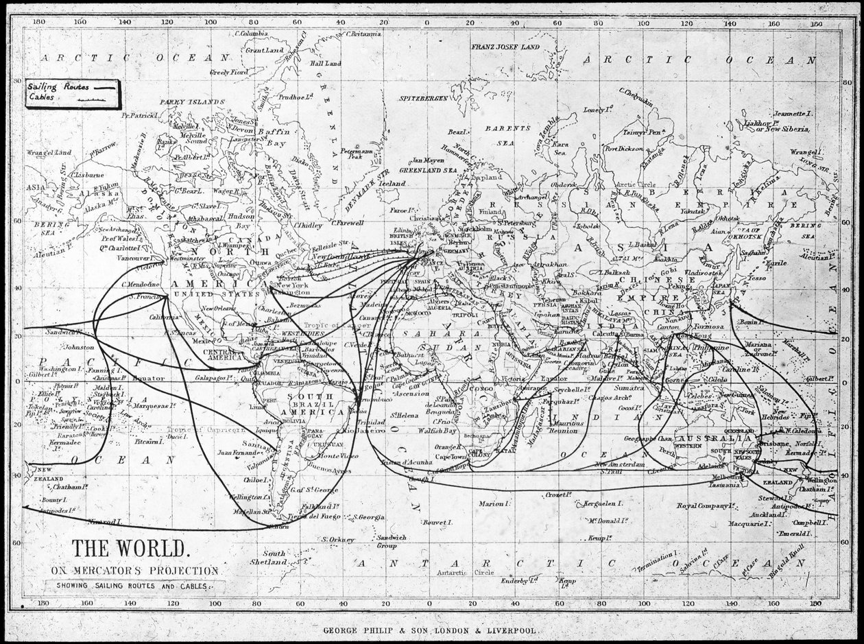
.jpg "Mapa świata przedstawiająca szlaki żeglarskie i kable telegraficzne, ok. 1893 r.")
.jpg "Teatr Zachodni, 1919.")
.jpg "Siedziba osadników, Kanada, koniec XIX wieku")
.jpg "Scena żniw na północnoamerykańskich preriach, koniec XIX lub początek XX wieku")
.jpg "Mapa Manitoby i północno-zachodniej Kanady, ok. 1893 r.")
.jpg "Widok Drezna w świetle księżyca")
.jpg "Sosny")
.jpg "Złota rybka")
.jpg "Nocne święto w Wersalu, 1906")
.jpg "Wschód księżyca nad morzem")
.jpg "Pocałunek")
.jpg "Scenografia do opery „Czarodziejski flet” Wolfganga Amadeusza Mozarta, zrealizowana przez Karla Schinkla (1781-1841)")
.jpg "U wybrzeży Connecticut, Newport, 1904")
.jpg "Artystka - Marcella")
.jpg "Teatr Marcellusa")
.jpg "Wiosenny przymrozek")
.jpg "Pierwsze kroki")
.jpg "Śmierć Sokratesa")
.jpg "Judyta ścinająca Holofernesa")
.jpg "Ogród artysty w Giverny, 1900")

 +43 4257 29415
 support@meisterdrucke.com
 Mo-Do: 7:00 - 16:00 | Fr: 7:00 - 13:00





