-
 ×
- Strona główna
- Wydruki ▸
- Artyści ▸
- Kategorie ▸
- Style sztuki ▸
- Rama ▸
- Nośniki druku ▸
- Wszystkie nośniki druku
- Płótno Leonardo (satyna)
- Płótno Salvador (matowe)
- Płótno Rafael (matowe)
- FineArt - Foto matowy
- FineArt - Foto satyna
- FineArt - Foto baryt
- FineArt - Foto błyszczący
- Tektura akwarelowa Munch
- Tektura akwarelowa Renoir
- Tektura akwarelowa Turner
- Tektura akwarelowa Dürer
- Natural Line Hemp
- Natural Line Rice
- Kozo White, 110g
- Kozo Natural, 110g
- Inbe White, 125g
- Unryu, 55g
- Bamboo, 110g
- Premio Unryu, 165g
- Murakumo Natural, 42g
- Bizan Natural, 300g
- Bizan White, 300g
- Kompozyt aluminiowy 3mm
- Szkło akrylowe 5mm
- Zamów zestaw próbek
- Które medium druku pasuje?
Płótno
Papier fotograficzny
Karton akwarelowy
Natural Line
Papier japoński
Media specjalne
Więcej informacji
- Pomoc i serwis ▸
- Skontaktuj się z nami
- Sprzedaj swoją sztukę
- Najczęściej zadawane pytania
- Oferty pracy
- Reklamacja
- Zamów próbki
- Zamów vouchery
- Koszty wysyłki
- Czas produkcji
- Zrównoważony rozwój
- Wyszukiwanie obrazów
- Specjalne życzenia
- Kim jesteśmy?
- Polityka cenowa
- Polityka firmy
- Obietnica jakości
- Wyróżnienia
- Blejtram
- Passe-partout
- Ramki dekoracyjne
- Szklenie
- Listwy
- Systemy montażowe
- Nośniki druku
- Wskazówki pielęgnacyjne
- Stopka redakcyjna
- Regulamin
- Ochrona danych
- Prawo do odstąpienia od umowy
Informacje i usługi
Więcej informacji
Warto wiedzieć
Informacje prawne
- Sklep ▸
- Kontakt


 Zobacz w 3D / AR
 Dodaj do ulubionych
 Wybierz kolor ściany
 Widok obrazu w pomieszczeniu
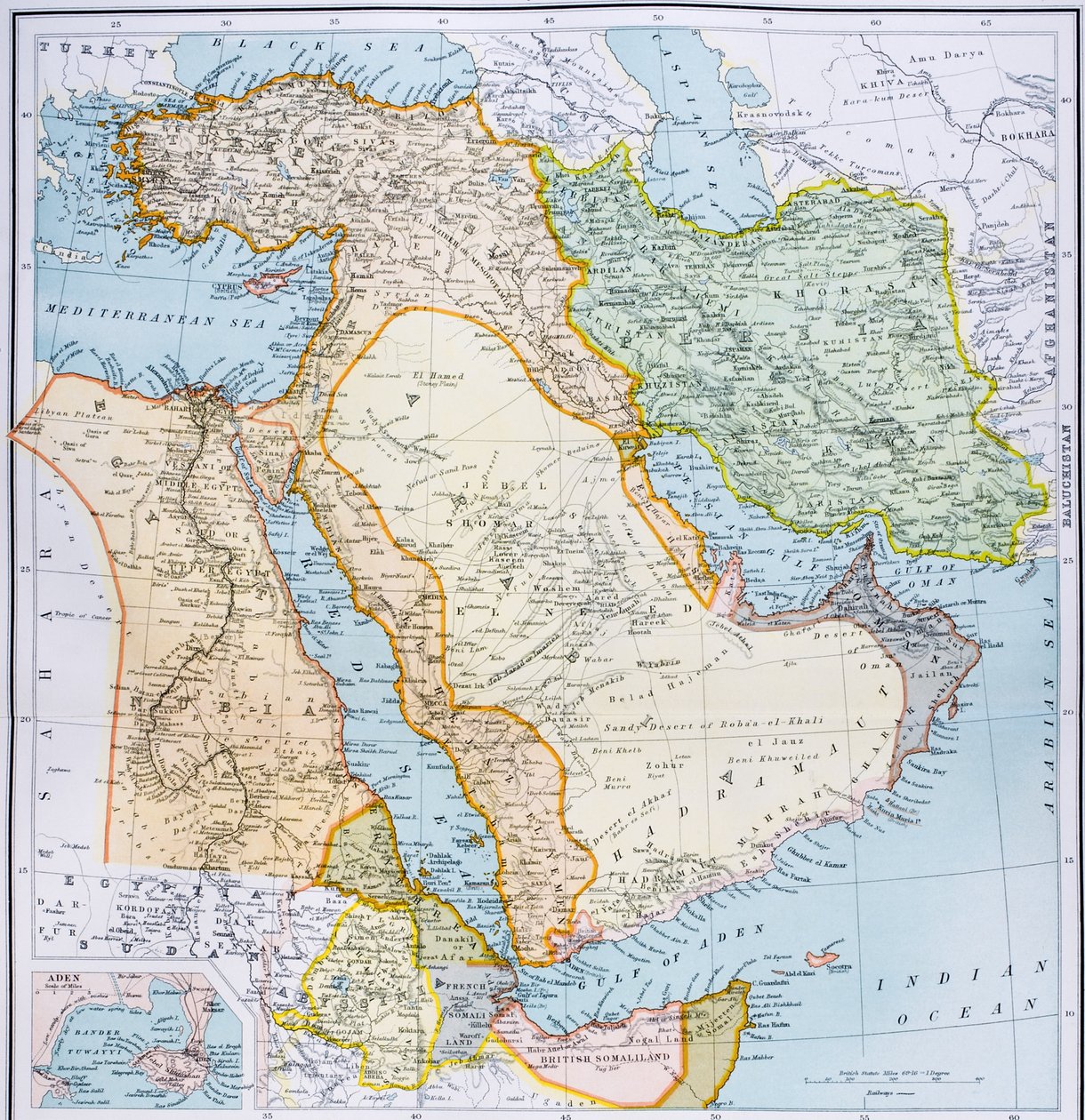
.jpg "Fragment mapy Bliskiego Wschodu w latach 1890., z „The Citizen")


.jpg "Azja Zachodnia")


.jpg "Częściowa mapa Bliskiego Wschodu w latach 90. XIX wieku, z „Atlasu świata obywatela”, wydanego w Londynie, około 1899")
.jpg "Turcja w Azji, Azji Mniejszej i Zakaukaziu.")


.jpg "Azja Mniejsza, Kaukaz i Morze Czarne")
.jpg "Imperia Persów i Macedonii.")


.jpg "Kanaan, czyli Palestyna w czasach Nowego Testamentu")
.jpg "Mapa Turcji, Arabii i Persji, według Guillaume de L")
.jpg "Imperia Persji i Macedonii")
.jpg "Kościół i domek z oświetlonymi oknami")


.jpg "Portret króla Ryszarda III")
 c1740-50 - (MeisterDrucke-77045).jpg "Kidbrooke Park, Kent, dawniej przypisywany George")


.jpg "Szczegółowa mapa półwyspu Gallipoli i Dardaneli w Turcji, 1915, z „The War Illustrated Album deLuxe”, opublikowanego w Londynie w 1916")


.jpg "Mapa świata z posiadłościami Imperium Brytyjskiego zaznaczonymi na czerwono, ok. 1870")


.jpg "Rysunek do mapy Księżyca, 1794")
.jpg "Mapa Londynu, pokazująca ogród z przynętami niedźwiedzi w Southwark, ok. 1561 r.")

 - (MeisterDrucke-55603).jpg "Mapa Morza Adriatyckiego")
.jpg "Mapa świata, z „Le Theatre du Monde” lub „Nouvel Atlas”, 1645")
.jpg "د لندن د Rocque له نقشې څخه لیکنه، د ښار د ایلډرمین او د هغوی د سیمو لیست، 1746 پولی")
 - (MeisterDrucke-362929).jpg "Mapa Irlandii, opublikowana ok. 1850 r. (rycina ręcznie kolorowana)")
.jpg "Mapa Marylebone w Londynie, 1746")

.jpg "Mapa Mile End i Stepney Green, Londyn, 1746")
.jpg "Mapa Battersea i Chelsea, 1748")

.jpg "Mapa Shoreditch i Whitechapel w Londynie, 1746")
.jpg "Mapa Covent Garden i Westminsteru w Londynie, 1746")
.jpg "Mapa St. James")
.jpg "Kwitnąca wiśnia")
.jpg "Walenccy rybacy")


.jpg "Pandemonium, 1841")

.jpg "Portret młodej kobiety, rysunek")

.jpg "Aleja w Overveen")


.jpg "Para jeźdźców")


 +43 4257 29415
 support@meisterdrucke.com
 Mo-Do: 7:00 - 16:00 | Fr: 7:00 - 13:00