-
 ×
- Strona główna
- Wydruki ▸
- Artyści ▸
- Kategorie ▸
- Style sztuki ▸
- Rama ▸
- Nośniki druku ▸
- Wszystkie nośniki druku
- Płótno Leonardo (satyna)
- Płótno Salvador (matowe)
- Płótno Rafael (matowe)
- FineArt - Foto matowy
- FineArt - Foto satyna
- FineArt - Foto baryt
- FineArt - Foto błyszczący
- Tektura akwarelowa Munch
- Tektura akwarelowa Renoir
- Tektura akwarelowa Turner
- Tektura akwarelowa Dürer
- Natural Line Hemp
- Natural Line Rice
- Kozo White, 110g
- Kozo Natural, 110g
- Inbe White, 125g
- Unryu, 55g
- Bamboo, 110g
- Premio Unryu, 165g
- Murakumo Natural, 42g
- Bizan Natural, 300g
- Bizan White, 300g
- Kompozyt aluminiowy 3mm
- Szkło akrylowe 5mm
- Zamów zestaw próbek
- Które medium druku pasuje?
Płótno
Papier fotograficzny
Karton akwarelowy
Natural Line
Papier japoński
Media specjalne
Więcej informacji
- Pomoc i serwis ▸
- Skontaktuj się z nami
- Sprzedaj swoją sztukę
- Najczęściej zadawane pytania
- Oferty pracy
- Reklamacja
- Zamów próbki
- Zamów vouchery
- Koszty wysyłki
- Czas produkcji
- Zrównoważony rozwój
- Wyszukiwanie obrazów
- Specjalne życzenia
- Kim jesteśmy?
- Polityka cenowa
- Polityka firmy
- Obietnica jakości
- Wyróżnienia
- Blejtram
- Passe-partout
- Ramki dekoracyjne
- Szklenie
- Listwy
- Systemy montażowe
- Nośniki druku
- Wskazówki pielęgnacyjne
- Stopka redakcyjna
- Regulamin
- Ochrona danych
- Prawo do odstąpienia od umowy
Informacje i usługi
Więcej informacji
Warto wiedzieć
Informacje prawne
- Sklep ▸
- Kontakt


 Zobacz w 3D / AR
 Dodaj do ulubionych
 Wybierz kolor ściany
 Widok obrazu w pomieszczeniu
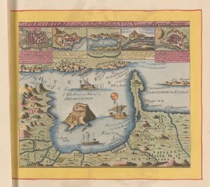
.jpg "Widok na Cieśninę Gibraltarską i okolice, z okopami oblężenia z 1704 r.")


.jpg "Miasto, zamek i opactwo Mont Saint-Michel, 1703")


 from John Speeds Theatre of the Empire of Great Britain pub by John Sudbury and George Humble 1611-12 (hand coloured copper engraving) - (MeisterDrucke-93357).jpg "Wyspa Wighta, rytowana przez Jodocusa Hondiusa (1563-1612) z „Teatru Imperium Wielkiej Brytanii” Johna Speeda, wyd. John Sudbury i George Humble, 1611-12 (ręcznie barwiony miedzioryt)")


 - (MeisterDrucke-52782).jpg "Oblężenie Malty, fragment z „Galerii Map Geograficznych”, 1580-83 (patrz także 260199)")


.jpg "Mapa wyspy Portoryko, 1599")


 og viser Christiania - (MeisterDrucke-543100).jpg "Mapa jest opublikowana w znaku ręcznym (1784) i przedstawia Christiania")


.jpg "Althea Cartwright")

.jpg "Portret króla Anglii Henryka IV, trzymającego królewskie berło, koniec XVI - początek XVII wieku")


.jpg "Liryczne")
.jpg "Samotność na morzu, 1852")
.jpg "Opierający się akt kobiecy z długimi włosami")
.jpg "Dwie dziewczynki w białych i niebieskich sukienkach")
.jpg "Przewoźnicy ładujący węgiel w świetle księżyca")

.jpg "Śnieg w Louveciennes, 1878")

.jpg "Rodzina")
.jpg "Wielki dzień jego gniewu")
.jpg "Drzewa owocowe, 1901")

.jpg "Błękitna Grota na Capri")
.jpg "Ogród w rozkwicie, Arles, lipiec 1888")

 +43 4257 29415
 support@meisterdrucke.com
 Mo-Do: 7:00 - 16:00 | Fr: 7:00 - 13:00